
In this update, we have focused on improving collaboration, adding new ways to update your Presents, upgrading cable generation, and expanding the default datasets in the Scout module.
New
- Collaborate Peer to Peer location sharing
Collaborate now shows the location of everyone working in the same project, on both the 2D map and in the 3D world. Markers are only visible when Collaborate is turned on, and you can click someone's icon to copy their view. You can adjust the marker size and visibility in the marker settings, under Settings.
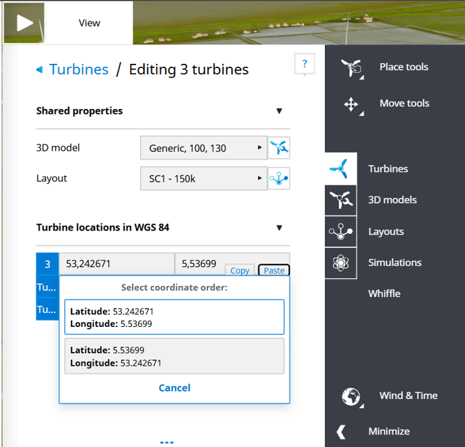
- Copy and paste coordinates
All coordinate input fields now have a Copy and a Paste button, so you can quickly move coordinates between fields. When you paste a coordinate, a confirmation window appears so you can check that the format is correct.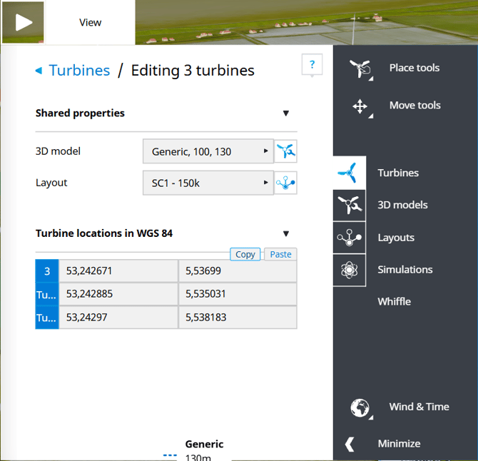
- Present updates
You can now update an existing Present. With this basic update, you can edit text, remove viewpoints and scenarios, and change the language and the default viewpoint or scenario.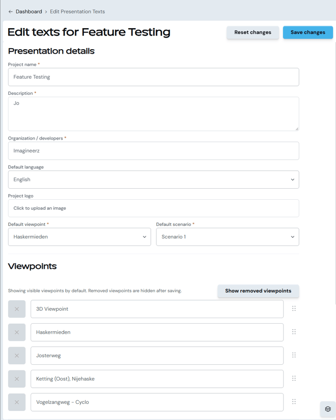
- Present replace
In addition to the standard update, Present now has a replace function. Replacing a Present updates it with the latest data from the original project, so changes to layouts or viewpoints are carried over. Previously, you had to recreate the Present from scratch. Now you can fully update it and keep the original URL. - Terrain texture import options
When importing a terrain texture, you can now choose whether the texture snaps to the terrain, whether it clips out the terrain at its location, and which height it uses. - Scout changes
Scout: new default datasets for Belgium and the UK
We have added default datasets for Belgium and the UK to the Scout module. Here is an overview:
- Belgium (WFS GRB): Adres, Administratief perceel, Gebouw aan de grond, Spoorbaan, Terrein, Wegsegment, VHA-waterloopsegment, and more.
- Belgium (WFS BWK & Natura 2000): BWK-zone, Faunistisch belangrijke gebieden, Habitattype 3260.
- Belgium (Protected Sites): CDDA, National Monuments Record, Natura 2000, Ramsar, UNESCO World Heritage.
- UK (Open Datasets): UPRN Address, TOID Topography/Highways/Sites, USRN.
- UK (Zoomstack): Airports, Boundaries, Contours, Roads (Local/Regional/National), Rail, Greenspace, Urban Areas, Waterlines, and more.
Improvements
- GeoJSON export and import
The EnergyPlanner-specific CSV export and import have been replaced by GeoJSON. You can still move objects from one EnergyPlanner project to another, and the export can now also be used as a regular vector layer.
- Cable generation update
We have improved cable generation so that more pylon types can be connected to each other, as long as their connections allow it. Cables now connect A to A, B to B, and so on, which prevents cables from crossing or intertwining.
- Layer in-use info and force delete
You can now delete custom map layers even if they are used in other projects, which makes it easier to clean up layers you no longer need. If you try to delete a layer that is in use, a pop-up shows which projects use it and lets you choose to delete it anyway.
- Shared sag warning feedback
When you change the shared sag, you now get a warning if the selected pylons do not all have the same sag value. Those values will be overwritten by the new shared sag.
- Visual update for BAG data
BAG data has a new, cleaner look. It now also uses the live dataset from TU Delft, so EnergyPlanner always shows an up-to-date version of the BAG buildings in the Netherlands.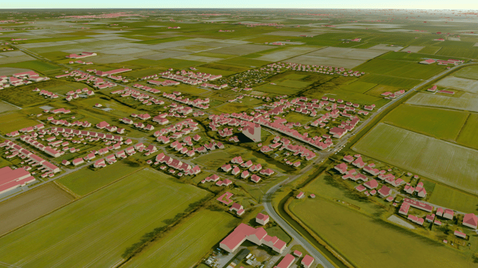
Fixes
- Time zone initialization
Fixed an issue where the time zone was not set correctly when loading a project.
Curious about what's next to come? Take a look at our roadmap.